


")
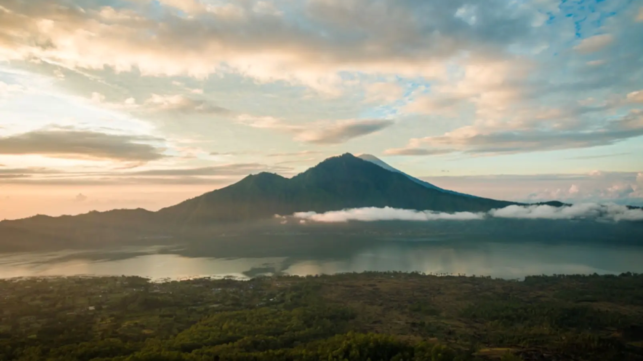
Mount Batur is one of the active volcanoes in Kintamani, Bali. Its first recorded eruption, reaching a height of 1,717 meters above sea level, occurred in 1804, with the latest eruption in 2000. Situated northwest of Mount Agung, it comprises three volcanic cones with corresponding craters, namely Batur I, Batur II, and Batur III. Throughout history, from 1804 to 2005, Mount Batur erupted 26 times, with the most powerful eruption recorded on August 2, 1926.
Surrounded by mountains in the Kintamani region, centered around the caldera of Mount Batur, it is renowned for its deep crater lake. The mountain also features hot springs often used for bathing. The clean mountain air, freshness, and breathtaking views in every direction make Kintamani one of the most popular tourist stops in Bali. There’s more to Mount Batur than just its location and elevation. Here are some interesting facts about Mount Batur:
- Dual Calderas
Mount Batur is a remarkable volcano with dual calderas and one crater inside another. As you get closer to Kintamani, you can approach an almost invisible horizon. Inside the crater is the black cone of Mount Batur, surrounded on the right by Lake Batur, and on the left, there’s a lava field formed by relatively recent volcanic eruptions and lush plantations.
- Legend of Mount Batur
The Mount Batur area is renowned as a prominent tourist attraction in the Bangli Regency of Bali. According to local stories documented in the Lontar Susana in Bali, Mount Batur is the peak of Mount Mahameru, moved by the deity Batara Pasupati to serve as the palace of Dewi Danu. At certain times, Hindus from various parts of Bali gather at Mount Batur to offer Suwinih to ward off pests in their fields, making the area fertile.
- Its Springs Flow into Lake Batur
Mount Batur has underground water flow that feeds into Lake Batur and is considered “Tirta Suci” (sacred water). Lake Batur is the largest lake in Bali, flowing from an underground spring network in the central-southern part of the mountain. Besides Lake Batur, there are hot springs for bathing. However, most tourists who visit Mount Batur are interested in hiking to the summit to enjoy views of Mount Agung and Mount Abang.
- Estimated to be as Large as Mount Agung Once
The size of the crater indicates that Mount Batur was once a much larger volcano, possibly comparable in size to Mount Agung nearby, whose summit erupted thousands of years ago. This active volcano had major eruptions in 1965, 1974, and 1994, erupting from the western flank and leaving large, sharp, needle-shaped lava rocks that now cast shadows.
- Trunyan Cultural Tourism
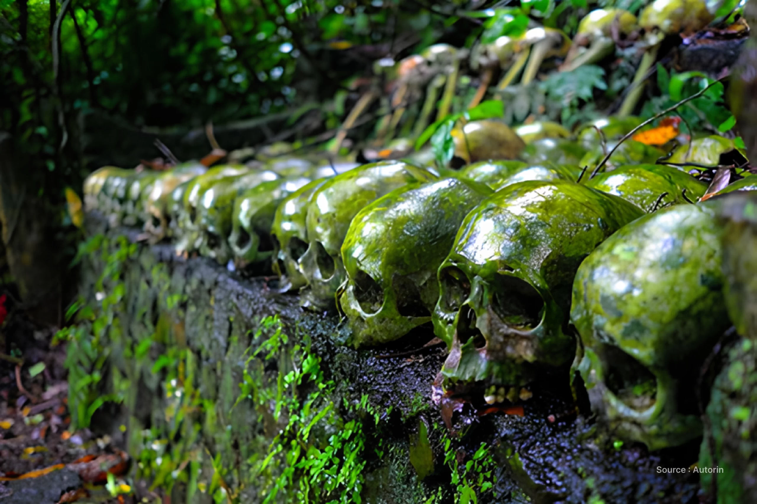
Apart from the trek to the summit for hiking enthusiasts, the cultural tourism in the Mount Batur area includes Trunyan. Despite all of Trunyan’s residents being Hindus like most of Bali’s population, they claim to inherit the original Hinduism from the Majapahit Kingdom. North of Trunyan lies Kuba, a village cemetery where bodies are not buried or cremated but placed under a tree after a complex death ceremony. This burial site is filled with skeletons, and there’s a possibility of encountering recently deceased bodies.
- Guide Services
The journey of 80 km from Nusa Dua or about 70 km from Kuta takes approximately 3 hours by car. Follow the main road towards the airport, then follow signs to Kintamani. Once you reach the crater’s edge, look for Toyabungkah Toll Road, where you’ll find hot springs and accommodations. Head to the Climbing Services where you’ll find the Mount Batur Guide Association office and mandatory guides. You can now also book climbing services online, usually through social media platforms like Instagram. There’s a trekking path, one starting from the village of Toyabungkah (1050m), or the more popular tourist trail from the Batur parking lot (1065m) one kilometer southwest of the village. The average climbing service cost is around Rp 100,000 per person, depending on the number of participants and services chosen.